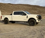
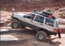
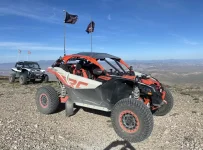
We've got our routes planned for both days of wheeling. Here's what to expect.
Friday – Gemini Bridges, Long Canyon, and Shafer Switchbacks
We'll hit the road by
8:30 a.m. to reach the Gemini Bridges trailhead by 9:00 a.m. We're running the trail from east to west. We'll air down in the parking lot at the trailhead before heading out.
The Route:
- Gemini Bridges Trail (east to west) – approximately 3 hours
- Turn south on Route 313 to Long Canyon Road – approximately 1 hour
- Take Long Canyon Road east to Route 279, then head south to Potash Road
- Potash Road through the Shafer Switchbacks – approximately 2 hours
- Air up at Island in the Sky Road, then head west to the visitor center for restrooms before returning to Moab
We'll stop at the
Potash Restrooms for a break before starting the Potash Road section.
Lunch Stop:We're planning to stop for lunch after completing Gemini Bridges. I'm looking at the
Horsethief Group Campsite north of the trail's end off BLM Road 340. If we can secure all four sites, it will accommodate our group—reservations open in March 2025, so I won't be able to book until then. The backup option is
Cowboy Camp Ground just south of Gemini Bridges off Route 313.
Estimated return to the resort: 4:00–5:00 p.m.
Route Map: onX Offroad Link
Saturday – Buttes and Towers, 3D Trail, Backwards Bill, and Sevenmile Rim
The Route:
- Start at US-191 and Mill Canyon Road, the beginning of Buttes and Towers Trail
- Head northwest to D2498, then southwest to connect to the 3D Trail
- At the end of 3D, head southeast a short distance to Bartlett Road*
- Take Bartlett Road northeast briefly to reach Backwards Bill
- Backwards Bill connects to Sevenmile Rim
- Sevenmile Rim connects back to Buttes and Towers, which we'll take east all the way back to US-191
*A Note on Timing: The 3D Trail alone could take a full day depending on conditions and our pace. At the end of 3D, we have an option: the trail connects to
CR137, which leads to
Route 313—both paved roads that will get us back to US-191. If the day is running long or folks are ready to call it, this is our bail-out point. We'll make that call as a group based on how things are going.
Fuel and Air-Up: A short distance south on US-191, there's a
Chevron on the left for those who need gas. Behind the Chevron is a large area where we can air up before heading back to the resort. If we cut it short at the end of 3D, we'll air-up there instead of at the Chevron.
Lunch Stop: There aren't any obvious pull-off areas along this route based on satellite imagery, so we'll find a spot to stop as a group. I'm thinking somewhere near the end of the 3D Trail before we start Backwards Bill.
Route Map: onX Offroad Link
Pack your lunches picnic-style for both days. More details on timing, waypoints, and CB/radio channels closer to the trip.
Questions? Drop them below.



 .
.